| Component | MiniNavInstrument |
|---|---|
| Module | ARCHEAN_celestial |
| Mass | 1 kg |
| Size | 25 x 25 x 25 cm |
Description
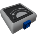
The MiniNavInstrument is a compact version of the NavInstrument. It provides the same navigation functionality in a smaller form factor, ideal for dashboards, small vehicles, or when space is limited.
Unlike the full-size NavInstrument, the MiniNavInstrument does not have an "OFF" mode - it defaults to Flight mode when no mode is specified.
Usage
The MiniNavInstrument requires low-voltage power (200 W). It offers the same three operating modes as the NavInstrument:
- Flight: Navigation in the environment of a celestial body
- Orbit: Navigation in orbit
- Locator: Locate object or celestial body
To switch between modes, send a mode value on channel 6 via the data port.
List of inputs
| Channel | Function | Value |
|---|---|---|
| 0 | Locate Celestial | text |
| 1 | Locate Distance | number |
| 2 | Locate Direction X | number |
| 3 | Locate Direction Y | number |
| 4 | Locate Direction Z | number |
| 5 | Forward vector config | 0 = forward, +1 = up, -1 = down |
| 6 | Set mode | 1 = Flight, 2 = Orbit, 3 = Locator |
List of outputs
| Channel | Function | Value |
|---|---|---|
| 0 | Forward Airspeed (m/s) | number |
| 1 | Vertical Speed (m/s) | number |
| 2 | Altitude (meters from sea level) | number |
| 3 | Above terrain (meters) | number |
| 4 | Horizon Pitch | -1.0 to +1.0 |
| 5 | Horizon Roll | -1.0 to +1.0 |
| 6 | Heading | 0.0 to 360 |
| 7 | Course | 0.0 to 360 |
| 8 | Latitude (degrees from -90 to +90) | -90 to +90 |
| 9 | Longitude | -180 to +180 |
| 10 | Ground Speed (m/s) | number |
| 11 | Ground Speed forward (m/s) | number |
| 12 | Ground Speed right (m/s) | number |
| 13 | Celestial | text |
| 14 | Celestial inner radius | number |
| 15 | Celestial outer radius | number |
| 16 | Orbital Speed (m/s) | number |
| 17 | Periapsis (meters) | number |
| 18 | Apoapsis (meters) | number |
| 19 | Prograde Pitch | -1.0 to +1.0 |
| 20 | Prograde Yaw | -1.0 to +1.0 |
| 21 | Retrograde Pitch | -1.0 to +1.0 |
| 22 | Retrograde Yaw | -1.0 to +1.0 |
| 23 | Locator Distance (meters) | number |
| 24 | Locator Pitch | -1.0 to +1.0 |
| 25 | Locator Yaw | -1.0 to +1.0 |
| 26 | Orbital Inclination | -180 to +180 |
| 27 | Orbit target Speed (m/s) | number |
| 28 | Orbit target altitude (meters from sea level) | number |
See the NavInstrument documentation for detailed information about each output.